New study shows: Lake Kariba’s basins respond differently to low water levels.
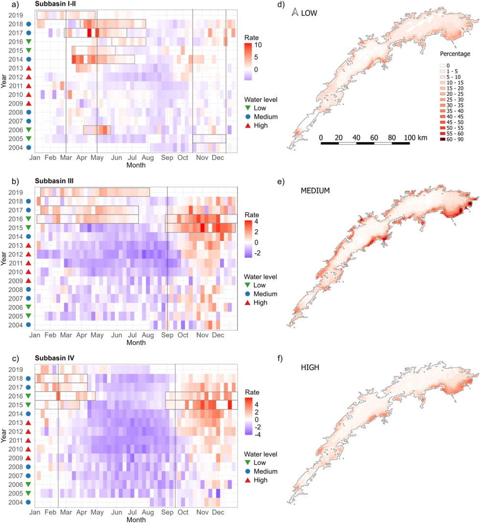
Using a novel integrated approach combining satellite data, including data from ESA's Climate Change Initiative Lakes project, with a 3D model across 14 years, researchers found that
💧 the upstream basin is particularly sensitive and
💧 downstream waters are more stable
Read the full study:
Image: Greife, A. J., Calamita, E., Pinardi, M., Carrea, L., Maidment, R. I., Pitarch, J., et al. (2026).
How water levels shape phytoplankton blooms across Lake Kariba, 2004–2018.
The heatmaps compare weekly changes in algae growth across the reservoir’s three basins. Symbols mark years with low, medium and high water levels. The maps show where persistent bloom hotspots occurred most frequently under each water-level condition. Satellite datasets from the European Space Agency’s Climate Change Initiative underpin the analysis.