senseFly, now AgEagle

@sensefly

We are now @AgEagleUAVS, provider of professional solutions in drones, sensors and software. Follow us there.

357 Following16.2K Followers5K Posts
  1. senseFly, now AgEagle@sensefly
    Follow us on our new account @AgEagleUAVS
    EagleNXT @EagleNXT
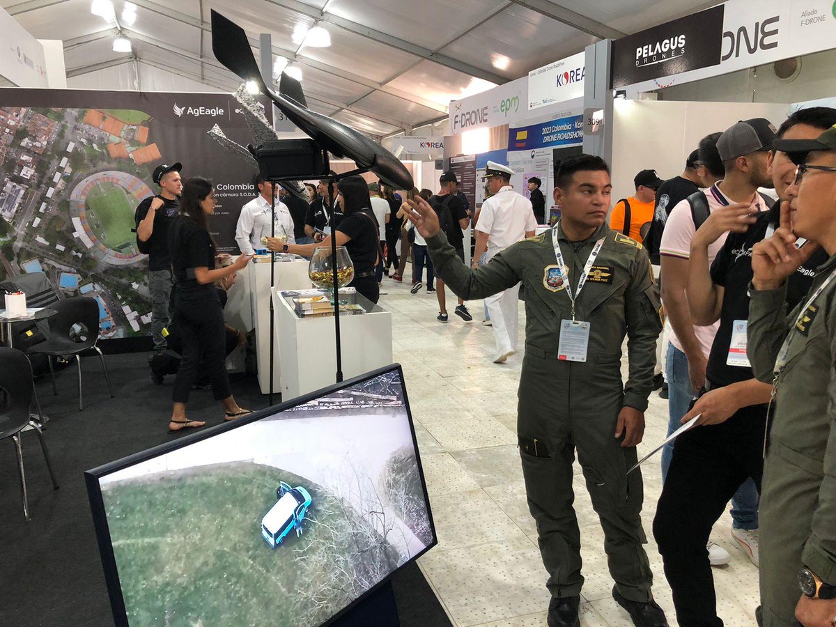
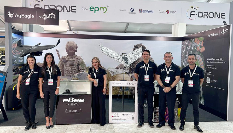
    Simultaneously capture, view and record HD video and imagery with #eBeeVISION. The new #UAS empowers #publicsafety and #defense professionals to perform day and night surveillance missions, even in GNSS-denied conditions. Now available to order: $UAVS
    0031.1K
  2. EagleNXT✓@EagleNXT
    Simultaneously capture, view and record HD video and imagery with #eBeeVISION. The new #UAS empowers #publicsafety and #defense professionals to perform day and night surveillance missions, even in GNSS-denied conditions. Now available to order: $UAVS
    Download
    35263.9K
  3. senseFly, now AgEagle@sensefly
    Follow us on our new account @AgEagleUAVS
    EagleNXT @EagleNXT
    NEWS OUT: AgEagle Launches Commercial Production of eBee VISION Drone; Now Accepting Orders from Customers Worldwide #eBeeVISION will empower drone operators to perform surveillance #ISR missions at a very high resolution even at night. Learn more: $UAVS
    0251.2K
  4. EagleNXT✓@EagleNXT
    NEWS OUT: AgEagle Launches Commercial Production of eBee VISION Drone; Now Accepting Orders from Customers Worldwide #eBeeVISION will empower drone operators to perform surveillance #ISR missions at a very high resolution even at night. Learn more: $UAVS
    Download
    44295K
  5. EagleNXT✓@EagleNXT
    Attending Commercial @ExpoUAV? Let's connect at booth 223! We'll be showcasing the innovative eBee VISION #UAS, the new RedEdge-P dual #dronesensor, and the unique features of Measure Ground Control #dronesoftware. Learn more:
    Download
    14205.6K
  6. senseFly, now AgEagle@sensefly
    Follow us on our new account @AgEagleUAVS
    EagleNXT @EagleNXT
    eBee VISION #UAS | Obtain real-time RGB and thermal insights, even in GNSS-denied conditions, to ensure the success of your Intelligence, Surveillance, and Reconnaissance (#ISR) missions. Book a demo or place a pre-order: #tacticalmapping #UAV
    0041.3K
  7. EagleNXT✓@EagleNXT
    eBee VISION #UAS | Obtain real-time RGB and thermal insights, even in GNSS-denied conditions, to ensure the success of your Intelligence, Surveillance, and Reconnaissance (#ISR) missions. Book a demo or place a pre-order: #tacticalmapping #UAV
    Download
    55193.7K
  8. senseFly, now AgEagle@sensefly
    Follow us on our new account @AgEagleUAVS
    EagleNXT @EagleNXT
    When the Morandi Bridge collapsed in Italy, an immediate survey for #disastermanagement became crucial. The #eBeeX drone with the S.O.D.A. 3D camera was chosen for its safety, fast data capture, and high-res 3D models accuracy. Explore the dataset here:
    013886
  9. EagleNXT✓@EagleNXT
    When the Morandi Bridge collapsed in Italy, an immediate survey for #disastermanagement became crucial. The #eBeeX drone with the S.O.D.A. 3D camera was chosen for its safety, fast data capture, and high-res 3D models accuracy. Explore the dataset here:
    Download
    53202.6K
  10. senseFly, now AgEagle@sensefly
    Follow us on our new account @AgEagleUAVS
    EagleNXT @EagleNXT
    The #eBeeVISION drone, 3.5 lbs / 1.6 kg, compact design, deployable in 3 minutes, and operable by 1 person. RGB and thermal #UAV operates in challenging environments to provide live HD video feed for intelligence, surveillance and reconnaissance (#ISR)
    0151.1K
  11. EagleNXT✓@EagleNXT
    The #eBeeVISION drone, 3.5 lbs / 1.6 kg, compact design, deployable in 3 minutes, and operable by 1 person. RGB and thermal #UAV operates in challenging environments to provide live HD video feed for intelligence, surveillance and reconnaissance (#ISR)
    Download
    124313.7K
  12. senseFly, now AgEagle@sensefly
    Follow us on our new account @AgEagleUAVS
    EagleNXT @EagleNXT
    The National UAS Training and Certification Center team at @SinclairUAS came to visit us! We discussed the use cases of #eBeeVISION drone, training programs, data processing and management for Government, Public Safety & Research customers. eBee drones:
    001528
  13. EagleNXT✓@EagleNXT
    The National UAS Training and Certification Center team at @SinclairUAS came to visit us! We discussed the use cases of #eBeeVISION drone, training programs, data processing and management for Government, Public Safety & Research customers. eBee drones:
    Download
    51232.9K
  14. senseFly, now AgEagle@sensefly
    Follow us on our new account @AgEagleUAVS
    EagleNXT @EagleNXT
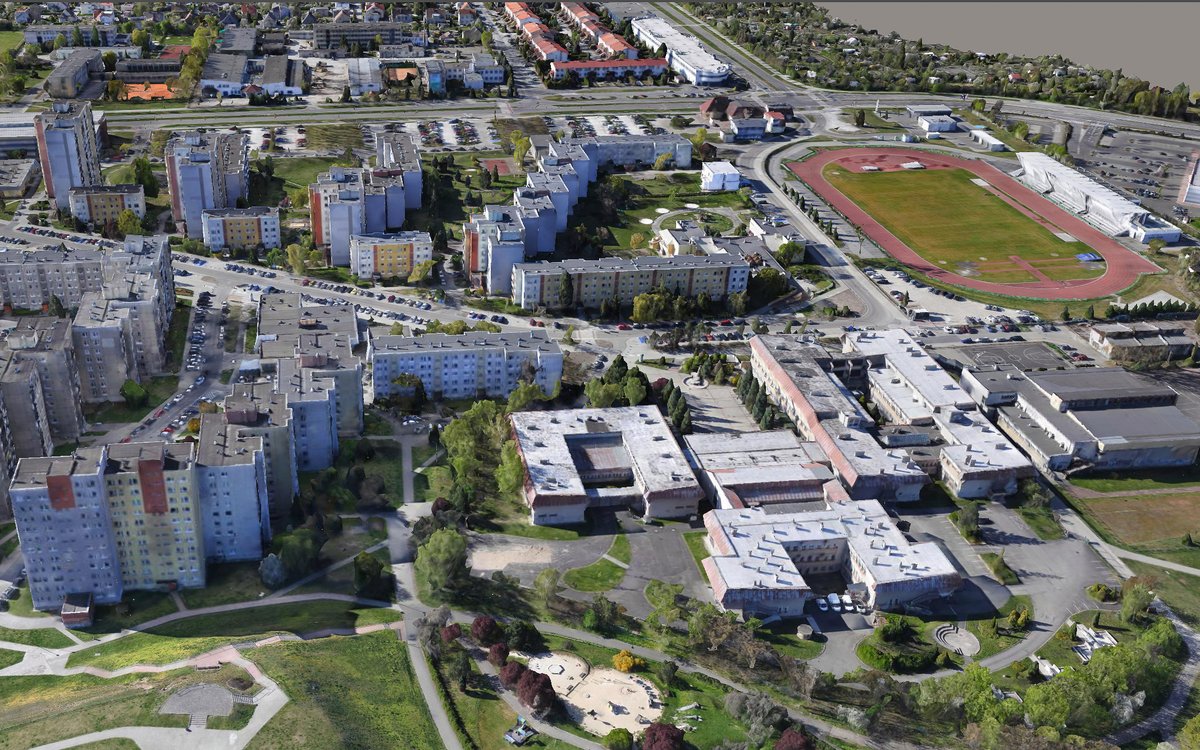
    Our partner in Colombia has created a #digitaltwin of the second most populous city with an eBee X #drone, which was selected due to its safety and permission to fly over people. Want to do a similar project? Check the features and new pricing of eBee X:
    022662
  15. EagleNXT✓@EagleNXT
    Our partner in Colombia has created a #digitaltwin of the second most populous city with an eBee X #drone, which was selected due to its safety and permission to fly over people. Want to do a similar project? Check the features and new pricing of eBee X:
    Download
    42202.8K
  16. senseFly, now AgEagle@sensefly
    Follow us on our new account @AgEagleUAVS
    EagleNXT @EagleNXT
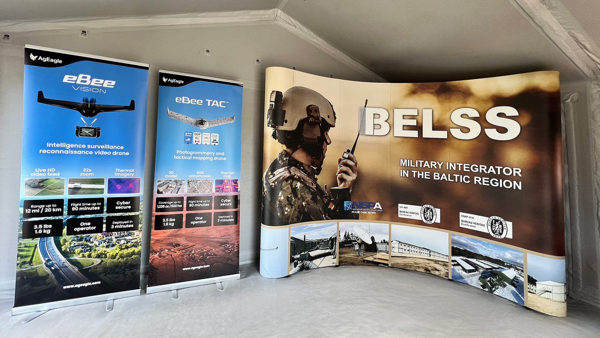
    eBee TAC and eBee VISION drones are in Latvia at the event organized by BELSS, the largest defense integrator in the Baltic region. ✔️#eBeeVISION real-time situational awareness #drone: ✔️#eBeeTAC tactical photogrammetry drone:
    000490
  17. EagleNXT✓@EagleNXT
    eBee TAC and eBee VISION drones are in Latvia at the event organized by BELSS, the largest defense integrator in the Baltic region. ✔️#eBeeVISION real-time situational awareness #drone: ✔️#eBeeTAC tactical photogrammetry drone:
    Download
    12152.1K
  18. senseFly, now AgEagle@sensefly
    Follow us on our new account @AgEagleUAVS
    EagleNXT @EagleNXT
    Our partner Geographica estimated the rooftop solar power potential of Sofia (Bulgaria) with two #eBeeX. The #UAV was selected due to its safety and permission to fly over people. Want to do a similar project? Explore the drone and its new pricing:
    013499
  19. EagleNXT✓@EagleNXT
    Our partner Geographica estimated the rooftop solar power potential of Sofia (Bulgaria) with two #eBeeX. The #UAV was selected due to its safety and permission to fly over people. Want to do a similar project? Explore the drone and its new pricing:
    Download
    25232.4K
  20. senseFly, now AgEagle@sensefly
    We are now @AgEagleUAVS, follow us on our new account.
    EagleNXT @EagleNXT
    Repositioning eBee X’s offering to $10,995 / €9’995 to ensure global affordability and enable operators to conduct safe operations with the NDAA-compliant UAS. This will further increase our competitiveness in multi-rotor market for larger scale missions:
    012536
  21. EagleNXT✓@EagleNXT
    Repositioning eBee X’s offering to $10,995 / €9’995 to ensure global affordability and enable operators to conduct safe operations with the NDAA-compliant UAS. This will further increase our competitiveness in multi-rotor market for larger scale missions:
    Download
    21242.6K
  22. senseFly, now AgEagle@sensefly
    Follow us on our new account @AgEagleUAVS
    EagleNXT @EagleNXT
    NEWS OUT: AgEagle Awarded Five-Year Multiple Award Schedule Contract by US Governments General Services Administration (“GSA”) Learn more: #eBeeTAC $UAVS #UAV #drones
    002498
  23. EagleNXT✓@EagleNXT
    NEWS OUT: AgEagle Awarded Five-Year Multiple Award Schedule Contract by US Governments General Services Administration (“GSA”) Learn more: #eBeeTAC $UAVS #UAV #drones
    Download
    19384.3K
  24. senseFly, now AgEagle@sensefly
    We are @AgEagleUAVS, follow us on our new account!
    EagleNXT @EagleNXT
    Drones are used at all stages of #publicsafety operations, from disaster and mitigation planning to aiding response and restoration efforts, including accurate mapping of flooded areas as shown below. Join our webinar with Drone Nerds to learn more: #UAV
    002632
  25. EagleNXT✓@EagleNXT
    Drones are used at all stages of #publicsafety operations, from disaster and mitigation planning to aiding response and restoration efforts, including accurate mapping of flooded areas as shown below. Join our webinar with Drone Nerds to learn more: #UAV
    Download
    23182.4K
  26. Show more posts