Ryan Maue✓

@RyanWeather

Weather + Climate | Look Up 🚀 | Florida State PhD + Michigan Go Blue! | Cat 6 🐈 | SI @weathertrader | Maps at @ForecastEagle + https://t.co/RZoMToAx1q

5.9K Following154K Followers30.9K Posts
  1. Ryan Maue✓@RyanWeather
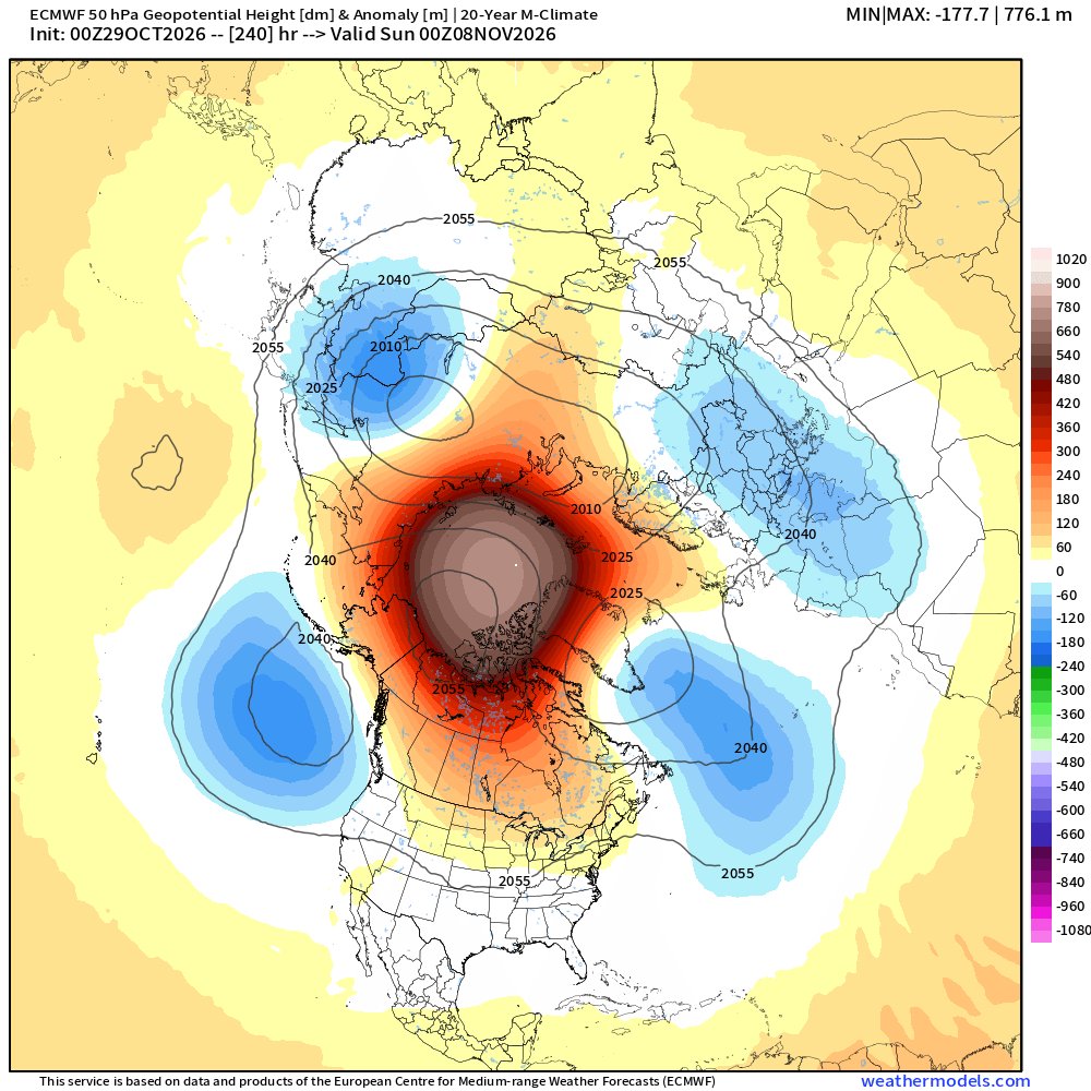
    🚨 This has never happened before. The Super El Niño has triggered an unprecedented early November stratospheric warming event (SSW) and wind reversal. 100% chance forecast. We must prepare for weather and climate events that were otherwise impossible until now.
    Download
    3819085.9K889K
  2. Ryan Maue✓@RyanWeather
    Boatloads of rainfall for Arizona over the next several days as a "fully loaded" Pineapple Express arrives from the Pacific Ocean. Phoenix at least 2" but could locally see 4" or 6"
    Download
    9221799.1K
  3. Ryan Maue✓@RyanWeather
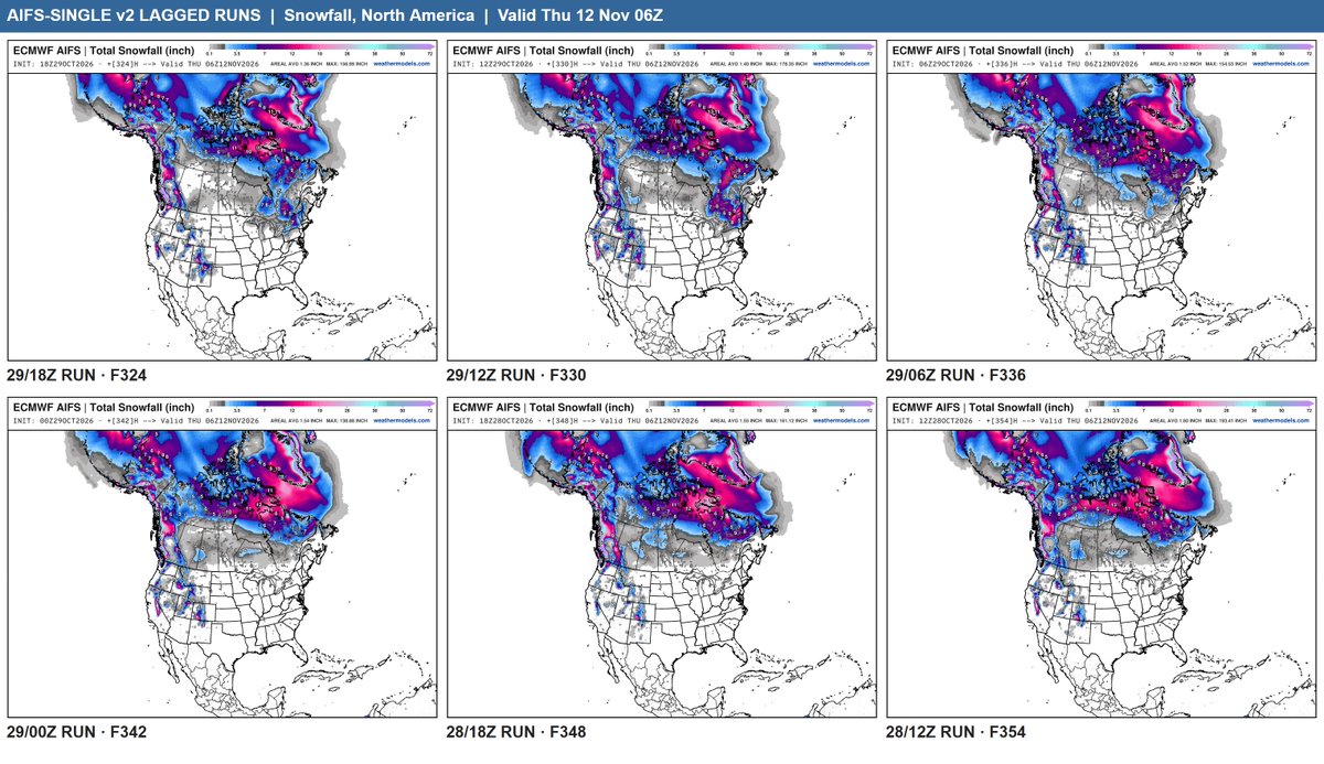
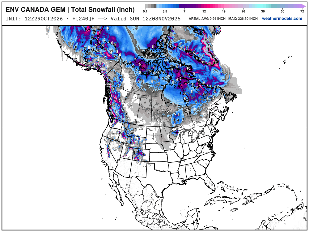
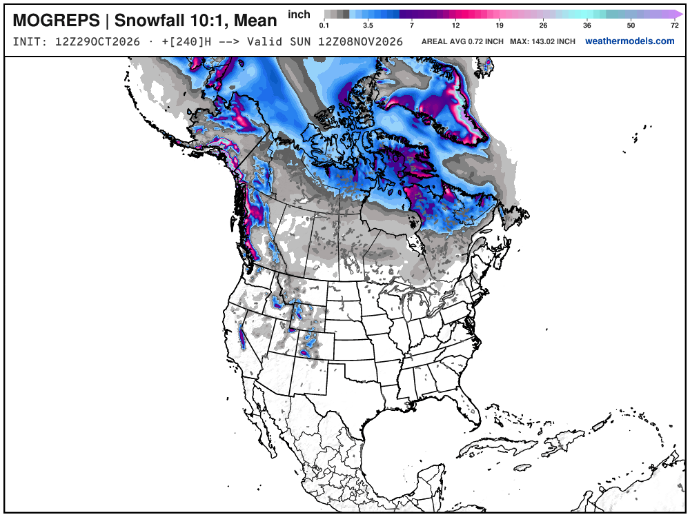
    Updated weather models + maps for Winter 2026-27 include v2 of AIFS-Single, AIFS-Ensemble, Canadian Hybrid-GEM, Met Office MOGREPS, RRFS-Ensemble
    Download
    Ryan Maue @RyanWeather
    When the clocks go backwards this weekend, weather models arrive an hour earlier again. 🙌
    14274.9K
  4. Ryan Maue✓@RyanWeather
    When the clocks go backwards this weekend, weather models arrive an hour earlier again. 🙌
    Download
    538112.1K
  5. Ryan Maue✓@RyanWeather
    Ryan Maue
    RT @zerohedge: "Uncharted Territory": Arctic Vortex Could Break Earliest On Record
    0470531
  6. Ryan Maue✓@RyanWeather
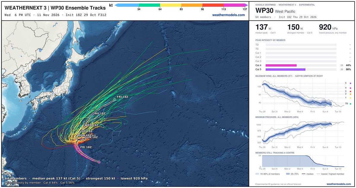
    Truck tire Typhoon In-fa over past 24-hours regained Super status ... now heading through Northern Mariana Islands on Friday. In-fa will do a little loop over the next week before finally heading into the North Pacific ... and perhaps bother the Canada/US West coast later.
    Download
    07405.1K
  7. Ryan Maue✓@RyanWeather
    Ryan Maue
    RT @MWObs: The 2027 Mount Washington Observatory calendars are available at Order NOW and use the code EARLY20 at checkout to get 20% off your order! Code EXPIRES at 2359 EDT on 10/30! Pick up your favorite today and enjoy a year of Mount Washington images! 🏔️📅🐱
    070774
  8. Ryan Maue✓@RyanWeather
    Time travelers
    Hodhodata@statistics @Statisticizer
    ❄️🌀🌎 Early November 2026 — Stratospheric Warming Signal Early-November Polar Sudden Stratospheric Warming (SSW) Signal | 3–10 November 2026 The latest structural-analog analysis is showing a notable increase in the likelihood of a possible early-November sudden stratospheric warming episode during 3–10 November 2026, with the signal particularly pronounced across the Eurasian and North American sectors. This early November SSW had also oddly materialized in November 2025, which is considered a rare event . The forecast is based on 20 candidate structural analogs for November 2026, with the resulting pattern remaining robust after resampling across 10 independent random-season ensembles. The 10-hPa temperature composite shows a pronounced positive temperature anomaly across the Arctic/polar stratosphere, with the strongest warming extending through the Eurasian and North American sectors. The accompanying 100-hPa vector-wind composite also indicates a highly disturbed circulation pattern around the polar region, providing additional evidence of an anomalous large-scale dynamical configuration during the same period. ⚠️ Important: This is not a confirmation of an SSW event. At this stage, it represents an analog-based probabilistic signal. Confirmation would require the dynamical evolution to produce the characteristic weakening and/or reversal of the 10-hPa polar-night jet, particularly in the zonal-mean winds near 60°N. The next level of verification is therefore to examine the 10-, 30-, 50-, and 100-hPa circulation structure, including the evolution of the polar vortex and the potential role of upward-propagating planetary wave-1 and wave-2 activity. If the temperature and wind signals remain dynamically coherent as we approach November, the case for an early-November stratospheric disruption becomes considerably stronger. 🔹 Forecast window: 3–10 November 2026 🔹 Method: Structural Analog Modeling + Random-Season Resampling 🔹 Candidate analogs: 20 🔹 Validation: 10 independent random-season ensembles 🔹 Primary diagnostic: 10-hPa polar temperature 🔹 Dynamical support: 100-hPa vector-wind structure See the previous forecast for Nov SSW signal found from June in the comments please . Statistical Model by @Statisticizer 🔋Powered by Aviatech Jordan & UAE-Dubai — Poultry Farm Equipment & Integrated Farming Solutions Aviatech Jordan
    46737.8K
  9. Hodhodata@statistics✓@Statisticizer
    ❄️🌀🌎 Early November 2026 — Stratospheric Warming Signal Early-November Polar Sudden Stratospheric Warming (SSW) Signal | 3–10 November 2026 The latest structural-analog analysis is showing a notable increase in the likelihood of a possible early-November sudden stratospheric warming episode during 3–10 November 2026, with the signal particularly pronounced across the Eurasian and North American sectors. This early November SSW had also oddly materialized in November 2025, which is considered a rare event . The forecast is based on 20 candidate structural analogs for November 2026, with the resulting pattern remaining robust after resampling across 10 independent random-season ensembles. The 10-hPa temperature composite shows a pronounced positive temperature anomaly across the Arctic/polar stratosphere, with the strongest warming extending through the Eurasian and North American sectors. The accompanying 100-hPa vector-wind composite also indicates a highly disturbed circulation pattern around the polar region, providing additional evidence of an anomalous large-scale dynamical configuration during the same period. ⚠️ Important: This is not a confirmation of an SSW event. At this stage, it represents an analog-based probabilistic signal. Confirmation would require the dynamical evolution to produce the characteristic weakening and/or reversal of the 10-hPa polar-night jet, particularly in the zonal-mean winds near 60°N. The next level of verification is therefore to examine the 10-, 30-, 50-, and 100-hPa circulation structure, including the evolution of the polar vortex and the potential role of upward-propagating planetary wave-1 and wave-2 activity. If the temperature and wind signals remain dynamically coherent as we approach November, the case for an early-November stratospheric disruption becomes considerably stronger. 🔹 Forecast window: 3–10 November 2026 🔹 Method: Structural Analog Modeling + Random-Season Resampling 🔹 Candidate analogs: 20 🔹 Validation: 10 independent random-season ensembles 🔹 Primary diagnostic: 10-hPa polar temperature 🔹 Dynamical support: 100-hPa vector-wind structure See the previous forecast for Nov SSW signal found from June in the comments please . Statistical Model by @Statisticizer 🔋Powered by Aviatech Jordan & UAE-Dubai — Poultry Farm Equipment & Integrated Farming Solutions Aviatech Jordan
    Download
    12107025.2K
  10. Ryan Maue✓@RyanWeather
    Posts @RyanWeather
    @webberweather @judah47 @dgoldweather For El Niño (and La Niña or neither) Please follow Professor Roundy from Albany
    Paul Roundy @PaulRoundy1
    It's obvious that this whole El Niño event traces profoundly back to the collosal April westerly wind event. But also look at the right panel, it is obvious that the event is also depleting Pacific warm water volume, with integrated Pacific wide volume of water above the 20C isotherm has been declining since April. Although some of that excess heat went directly to space, much of it was transferred as sensible and latent heat into the atmosphere, which will be impacting weather outcomes over the next several months. The event will almost certainly lead to a period of heat deficit (relative to the long term trend line) in the climate system. It is interesting that the warmest naturally achieved heat signals reflect times with the earth is actually cooling.
    4109379.6K
  11. Paul Roundy✓@PaulRoundy1
    It's obvious that this whole El Niño event traces profoundly back to the collosal April westerly wind event. But also look at the right panel, it is obvious that the event is also depleting Pacific warm water volume, with integrated Pacific wide volume of water above the 20C isotherm has been declining since April. Although some of that excess heat went directly to space, much of it was transferred as sensible and latent heat into the atmosphere, which will be impacting weather outcomes over the next several months. The event will almost certainly lead to a period of heat deficit (relative to the long term trend line) in the climate system. It is interesting that the warmest naturally achieved heat signals reflect times with the earth is actually cooling.
    Download
    141716091.4K
  12. Ryan Maue✓@RyanWeather
    Posts @RyanWeather
    It may seem counterintuitive but the warming causes cooling down the road. Stratospheric polar vortex breakdown eventually works its way to our part of the atmosphere leading to massive dumps of cold air ... or Arctic blasts. Hopefully the Super El Niño counteract the potential for record cold later in November. Otherwise, I'm getting my snowblower out here in Atlanta.
    567015K
  13. Ryan Maue✓@RyanWeather
    I will entertain any and all theories linking the Hunga Tonga 🌋 eruption on January 15, 2022 and massive input of water vapor in the strarosphere to the fake El Niño of 2023, the weird polar vortex activity both Arctic and Antarctic, and the current Super Intensity El Niño due to westerly wind bursts. Mind you, 1997 El Niño was post Pinatubo, similar timeline. The slow background climate warming explains none of this. Everything is happening on top of the century scale global warming. I'm awaiting any explanation.
    1979011.9K
  14. Ryan Maue✓@RyanWeather
    Ryan Maue
    RT @dgoldweather: In development at a new SSW monitoring page. Most views stop at “will the polar vortex break down/westerlies reverse?” This one lets you examine the event drivers and how likely it is to impact sensible weather. We try to lay out the whole causal chain: wave forcing from the troposphere, the vortex response and the way back down: anomaly descent, tropospheric coupling and high-latitude blocking. Included are days 1-15 forecasts from AIFS-ENS and 101-member ECMWF 46-day extended range ensemble, centered on the model’s own climate. Finally we leverage our 58-year CORe archive for historical context.
    030816
  15. Ryan Maue✓@RyanWeather
    Sad news to report. 🇺🇸NOAA's global weather model GFS will not be upgraded this month, or next, but sometime in "late 2027" or maybe not at all. On the 14th anniversary, we should remind everyone that the "Euro nailed Sandy."
    Download
    145640141.1K
  16. Ryan Maue✓@RyanWeather
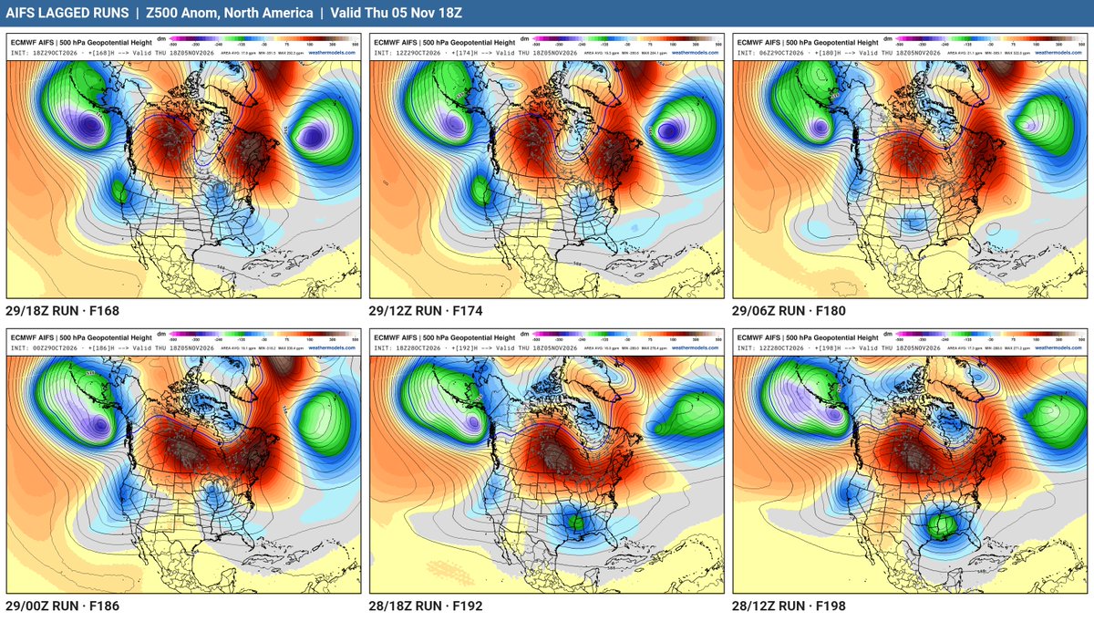
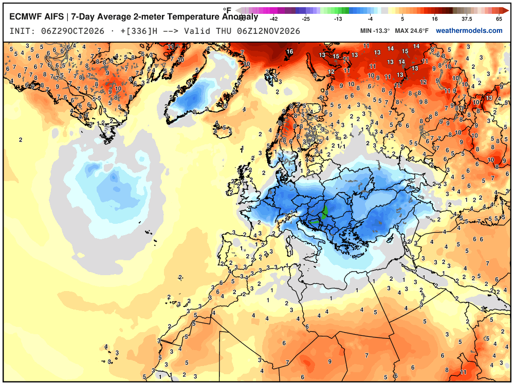
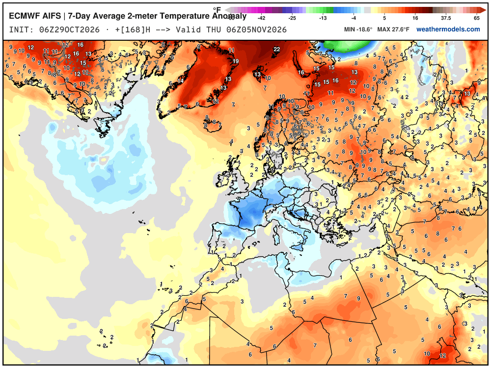
    ⚠️Chilly weather across Europe roiling the gas markets is related to "wave breaking" along the polar front on the eastward flank of a persistent omega block -- creating little cut-off lows that travel westward. Not cold enough for snowfall, thankfully. Little "tear drops" of potential vorticity + mid-level cold air descending from the subarctic and survive for many days ... coherent fuzzballs of cut-off circulation. Pattern is stuck for 10-days due to blocking rebuilt by bomb cyclones / downstream Rossby wave dispersion off Canadian coast. Meteorology is so much fun b/c it's all connected!
    Download
    41615317.5K
  17. Ryan Maue✓@RyanWeather
    Posts @RyanWeather
    Everywhere else is warmer than normal ... but Europe is stuck beneath the blocking ridge ... it's a weird pattern because you'd think high pressure = warm for Europe. Nope, not in November. The air originates from the Arctic but gets there "coming from around the block" Similar pattern across North America, but we don't have the cold air repository quite like Eurasia.
    Download
    03163.4K
  18. Ryan Maue✓@RyanWeather
    Ryan Maue
    RT @burgwx: Something I've noticed increasingly as of late is a misconception - even among some weather enthusiasts - of what studying meteorology means & what meteorologists use models for. Well-learned meteorologists don't just read model output verbatim - but models also aren't useless.
    0110862
  19. Show more posts