Posts with #Geosphere

#Geosphere

Public posts on X that use #Geosphere.

Related hashtags

  1. geosociety@geosociety
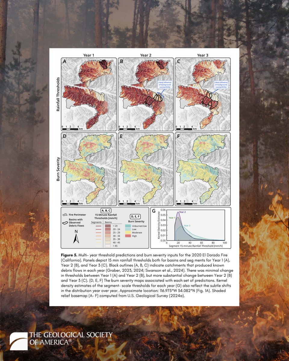
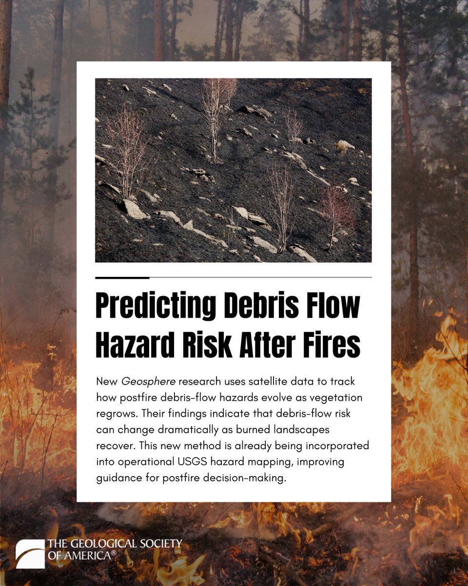
    How do wildfire landscapes recover? And how does that change debris-flow risk over time? A new study in #Geosphere introduces an improved, satellite-based method for tracking how postfire debris-flow hazards evolve as vegetation regrows. By integrating multi-year burn recovery into the USGS “M1” hazard model, the authors show that debris-flow risk is not static—it decreases (and sometimes changes substantially) as burned landscapes recover. This recovery-aware approach improves rainfall threshold predictions and reduces false alarms, helping emergency managers better distinguish when a burned watershed is still dangerous versus when it has begun to stabilize. The method is already being incorporated into operational USGS hazard mapping workflows, improving guidance for postfire decision-making. This work is now also gaining broader attention, including coverage in EOS; read the paper: #WildfireRecovery #GeologicalHazards #HazardRisk
    Download
    245827
  2. geosociety@geosociety
    How and when did the Grand Canyon form? Geologists are still debating one of Earth’s most iconic landscapes. Research published in #Geosphere explores evidence that an ancient proto–Colorado River may have filled a vast basin in northern Arizona before spilling westward—potentially helping establish the modern course of the Colorado River through the Grand Canyon. This study argues against the spillover hypothesis based on evidence suggesting that the preserved lake deposits represent a shallow, playa-like lake rather than a deep, overflowing lake. Thus, this work supports a more gradual integration of the Colorado River system. However, new research published in Science and featured in Scientific American presents new evidence that supports both the spillover hypothesis as well as an older more gradual integration of the Colorado River system. This new study suggests that by around ~6.6 million years ago, an ancestral Colorado River was flowing into the northern Arizona basin, where a large lake (or lake system) likely formed and eventually spilled westward to establish the modern Colorado River pathway through the Grand Canyon. So, the debate is no longer “Did spillover happen at all?” but rather “How important was spillover relative to older canyon segments and gradual river integration?” Although further research is needed to answer this question, these studies add important insight into the long-running puzzle of when and how the Grand Canyon was carved. Read the Geosphere paper: #Geology #GrandCanyon
    Download
    0316995
  3. geosociety@geosociety
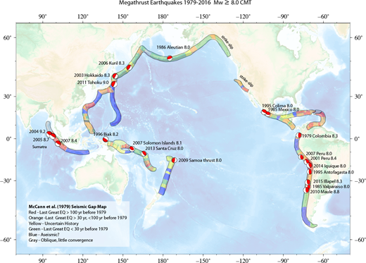
    New #Geosphere research explores a provocative idea: that the Cascadia Subduction Zone and northern San Andreas Fault may not act entirely independently—but could partially influence each other through time. Using offshore sediment records spanning the past ~3,000 years, researchers identified evidence that some major earthquakes on these two fault systems may have occurred in closely linked sequences, raising new questions about stress transfer and earthquake synchronization along the U.S. West Coast. The study combines marine paleoseismology, turbidite stratigraphy, radiocarbon dating, and seismic records to investigate how these fault systems may interact near the Mendocino Triple Junction—one of the most tectonically complex regions on Earth. This work is gaining broader attention through coverage in outlets including KQED and the San Francisco Chronicle—read the paper: #Earthquakes #Seismology #Cascadia #SanAndreasFault
    Download
    0310889
  4. Geological Society of America Publications✓@GSAPublications
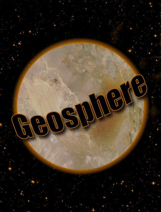
    The first 2025 #Geosphere issue is now online and 100% #openaccess! Topics span from the Cretaceous magmatic arc of southwestern North America to gender, geoscience, and work-from-home initiatives. The issue includes a Queen Charlotte-Fairweather Fault System themed issue paper. February Geosphere cover image of the Lut Desert (southeastern Iran) is from NASA Earth Observatory.//Go to to have a better look at the cover and to view all articles. #GSAPubs #Geoscience #EarthScience
    Download
    0218883
  5. geosociety@geosociety
    What if the mountains you see today slid 16 km from where they formed? New #Geosphere research uncovers that Utah’s east Traverse Mountains aren’t uplifted by faulting—they’re a massive late-Miocene mega-landslide (~75–150 km³!) that broke free from the Little Cottonwood stock. This discovery changes how we see mountain building and landslide hazards in extensional terrains. 🔗 Read more: #GSAPubs #UtahGeology #WasatchFront #StructuralGeology #Geoscience
    Download
    26541.5K
  6. geosociety@geosociety
    New #Geosphere research on the Famatinian arc (NW Argentina) reveals two distinct magmatic stages—shaped by mantle-crust interactions and pre-existing lithosphere. Read more: #GSAPubs
    Download
    14191.2K
  7. Geological Society of America Publications✓@GSAPublications
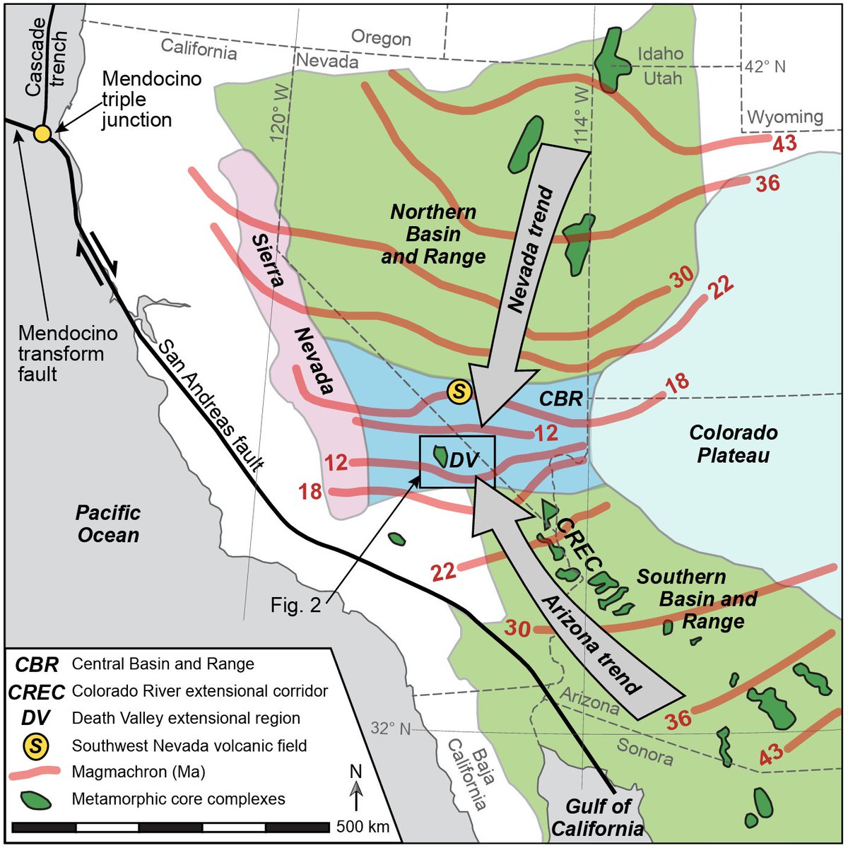
    New #Geosphere Publication: 'Tracking the spatial and temporal links between late Cenozoic extension and magmatism in the Death Valley region (California, USA).' Chan et al.'s research presents high-precision U-Pb zircon ages, revealing three distinct phases of intrusive magmatism and their correlation with regional extension. Key findings highlight the plutonic record as a critical link to understanding tectonic changes. Read the full paper here: #GSAPubs #Magmatism #EarthScience #Geochronology
    Download
    06411.8K
  8. geosociety@geosociety
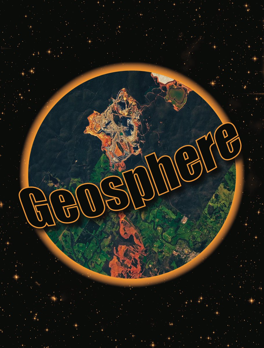
    🌍 The June 2025 issue of #Geosphere is here—and it’s 100% #openaccess! Explore tectonics across North America, from the Sierra Nevada to the Basin and Range, plus stunning fossil reef imagery from west Texas. Read now: #GSAPubs #Geoscience
    Download
    02131.1K
  9. geosociety@geosociety
    New research in #Geosphere presents the first systematic investigation of paleoearthquake timing along the Western Nepal fault system, a major fault zone that cuts obliquely across the high Himalaya in Nepal. Our study shows that all trenched faults ruptured during the Holocene, suggesting the potential for complex multifault ruptures and highlighting additional seismic hazards within the upper plate of the Himalayan megathrust, with possible linkages to megathrust earthquakes. Read the full article: #Paleoseismology #Earthquakes #Tectonics #Himalaya #SeismicHazards #ActiveFaults Photo by Gagan Raj Rai on Wikimedia Commons.
    Download
    0414970
  10. Show more posts