Posts with #SpatialData

#SpatialData

Public posts on X that use #SpatialData.

Related hashtags

  1. Geoawesome@geoawesome_dgtl
    Satellites generate tons of data, but most workflows can’t keep up! 🌍 Spatial Data Cubes organize observations across space & time, making long-term environmental analysis faster and smarter. Learn how: #EarthObservation #SpatialData #Geoawesome
    Download
    05421.6K
  2. Esri@Esri
    It's a whole new frontier in analytics! This course explores the application of spatial data science to uncover hidden patterns and improve predictive modeling. Sign up for the (free!) #SpatialData Science course here: #ArcGIS @EsriTraining
    Download
    0937
  3. Vizgen@vizgen_inc
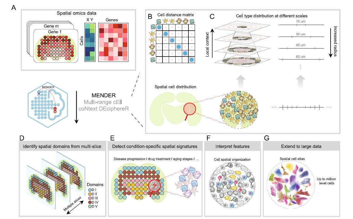
    We love learning about new #ComputationalTools for analyzing #SpatialData! MENDER is a novel tissue structure identification tool utilizing cellular neighborhood structures observed across spatial technologies now published in @NatureComms. Learn more:
    Download
    012478.5K
  4. Geoawesome@geoawesome_dgtl
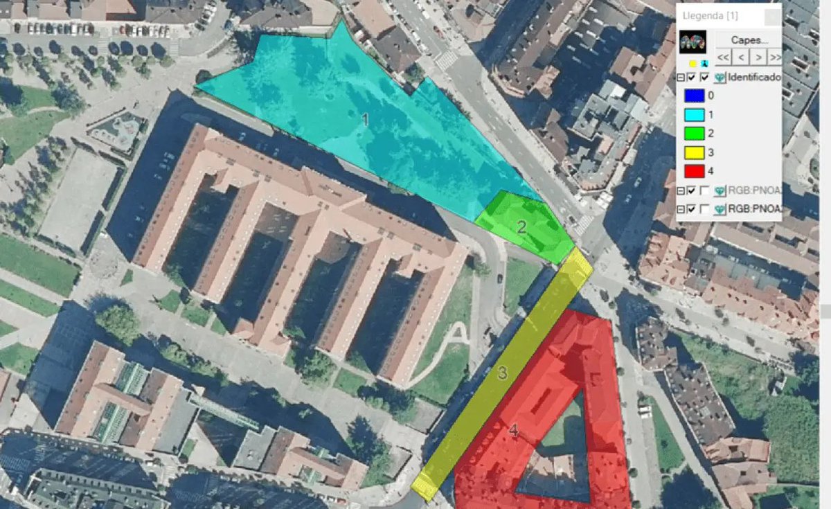
    🗺️ Fun fact: MiraMon GIS has been shaping geospatial science for 30 years, downloaded in 42 countries! It helps visualize, analyze, and digitize maps with tools like dynamic topology & full OGC API support. 👉 #Geoawesome #GIS #SpatialData #OpenSource
    Download
    03452.9K
  5. Matterport@Matterport
    Watch this clip with Matterport CEO @rjpittman as @TravisHoium asks how Matterport stays ahead and differentiates itself from the competition. Find out how our #AI solutions like Property Intelligence are made possible by our massive #spatialdata library:
    05151.1K
  6. CARTO@CARTO
    We are thrilled to announce the Spatial Data Science Conference is back, bigger and better than ever! It is the first event to bring together Data Scientists and Developers who specialize in working with #SpatialData. Join us for this unique event! #SDSC19
    0928
  7. CARTO@CARTO
    We are thrilled to introduce GeoParquet! A proposal to standardise how to work with #SpatialData on Parquet. Goal is to increase spatial interoperability on the Data Clouds so GEO become Cloud-Native:
    Download
    41039
  8. G E E K U L C H A 🇿🇦✓@Geekulcha
    REGISTRATION OPEN FOR LOKATE MY KASI CHALLENGE Let's congregate on the 7th of December at UNISA for the Lokate My Kasi challenge. What will you build with Mapping Intelligence and Spatial Data? REGISTER HERE: #LokateMyKasi #SpatialData
    Download
    3571.5K
  9. Luca Marconato@LucaMarconato2
    @LucaMarconato2
    5/9 Examples of using our @napari_imaging plugin to visualize and annotate a #SpatialData object in napari (sharing the screen with Sidecar). Thanks to the Zarr storage we can smoothly visualize many large images together. Credits to @WVierdag for his work on the lasso tool.
    Download
    28394.1K
  10. Luca Marconato@LucaMarconato2
    @LucaMarconato2
    6/9 With #SpatialData you can represent complex datasets and transfer annotations and derived metrics across spatial modalities. The utility of SpatialData is illustrated via multiple vignettes, including integrative analysis on a multimodal Xenium and Visium breast cancer study.
    Download
    14171.9K
  11. Felt@felt
    Meet Felt’s native H3 support. Just like all things we build, it really flies. Here are 3 reasons H3 in Felt is so unique ⤵️ #GIS #Mapping #SpatialData
    Download
    3113613.2K
  12. Luca Marconato@LucaMarconato2
    1/7 Here is a technical update for the latest release of the #SpatialData package from last week. We thank the core developers and contributors for helping us refine the framework, and the users for the precious feedback and discussions. GitHub repository:
    2339326.5K
  13. AURIN@aurin_org_au
    We are delighted to announce that the number of datasets available through the #AURINPortal has now exceeded FIVE THOUSAND!! many thanks to our Data Partners and Network for their dedication to enabling access to #spatialdata for our research community!
    Download
    1511
  14. Show more posts