Posts with #dataplotly

#dataplotly

Public posts on X that use #dataplotly.

Related hashtags

  1. Geoinnova@GeoInnovaASL
    📊 ¿Conoces DataPlotly? Este complemento de #QGIS permite crear gráficos interactivos directamente a partir de los atributos de tus capas, sin necesidad de exportar los datos a otras herramientas. #DataPlotly #GIS #SIG #Geospatial #QGISPlugin
    0617771
  2. Gis3w@_Gis3W_
    #G3WSUITE version 3.1 will be released on November 18th! Many new features: greater integration with the #QGIS API, visualization of graphics created with #DataPlotly plugin, printing of atlas, new online editing tools ... and much more ...
    Download
    023
  3. Gis3w@_Gis3W_
    #G3WSUITE 3.2 is coming! Great news about #DataPlotly plugin integration! Activate charts and make them dynamic with filters based on map content
    Download
    01846
  4. Calep Pimienta@CalepPimienta
    Tarde pero seguro! A ver si me mantengo en el resto del #30daysmapchallenge 🎉Ahí van los de la semana👇🏽 1/9: Radiación solar media estacional en México.
    Download
    1011
  5. Calep Pimienta@CalepPimienta
    @CalepPimienta
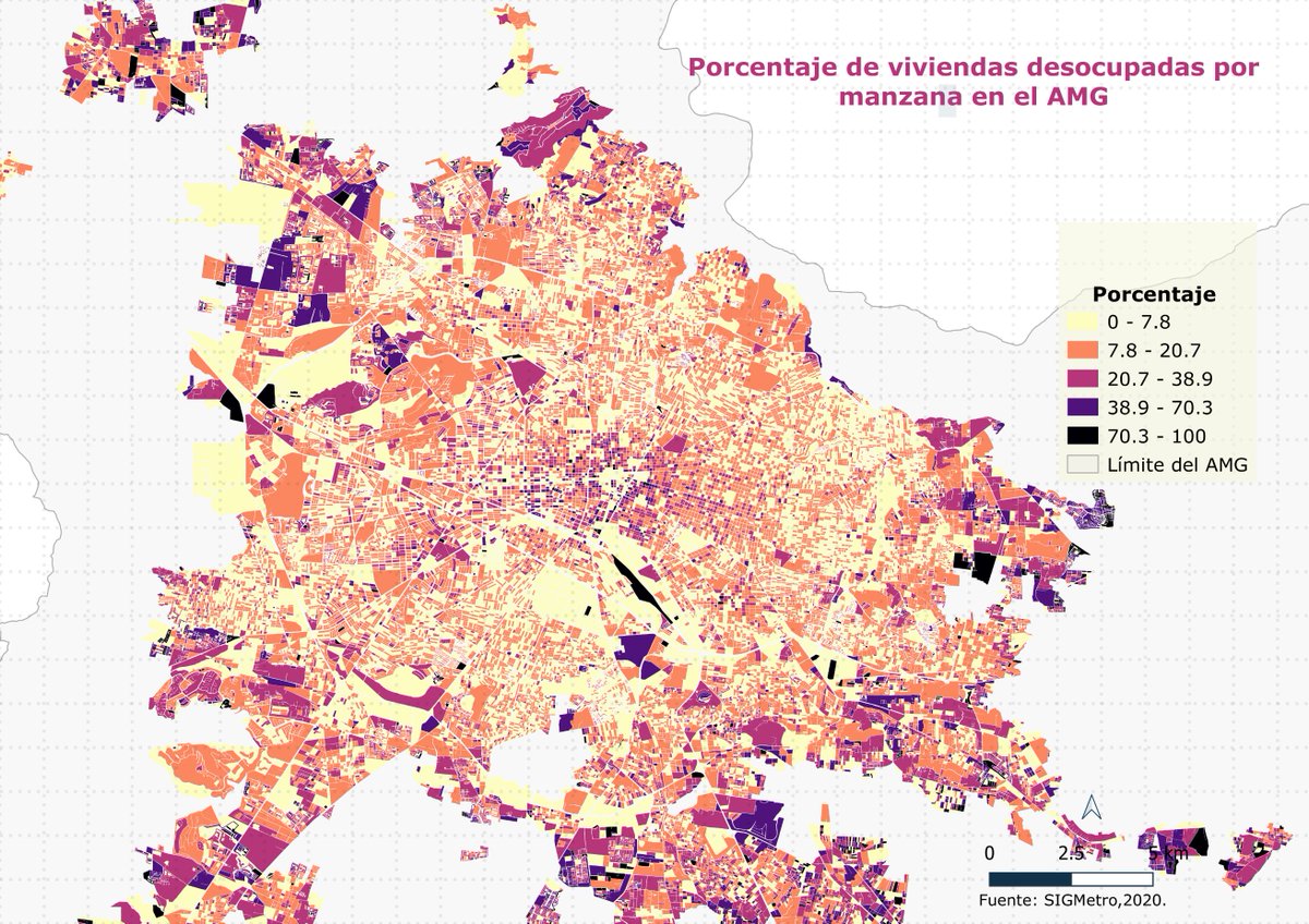
    Mapa 9: A petición de @NevandoAndo un mapita del porcentaje de viviendas desocupadas por manzana en el AMG. La info es descargable del SIGmetro, no hay como tal un registro de "número de viviendas" desocupados pero algo es algo. #30daysmapchallenge
    Download
    226
  6. Faunalia@FaunaliaGIS
    Our #DataPlotly and the new QGribDownloader (thanks Enrico Ferreguti) showing up during the #QGIS workshop of Birds Eye View!
    027
  7. Faunalia@FaunaliaGIS
    Presentazione di #DataPlotly. A brevissimo lanciamo il crowdfunding.. stay tuned!
    016
  8. Gis3w@_Gis3W_
    #G3WSUITE 3.2 is coming! Great news about #DataPlotly plugin integration! Carry out your searches and filter the graphs based on the search results #QGIS
    Download
    0522
  9. Faunalia@FaunaliaGIS
    Matteo Ghetta #DataPlotly talk recorded during the last #QGIS User Conference in A Coruña. Have a look at it!
    004
  10. Bleumar@val_orsi
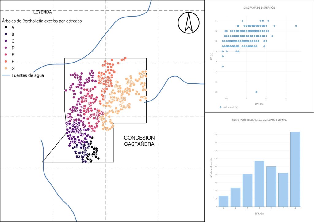
    Les presento un mapa de dispersión de árboles de castaña (B. excelsa) geo-referenciadas por estradas con dos gráficos realizados con #dataplotly : - Diagrama de dispersión entre los DAP (diámetro a la altura del pecho) y HT (altura total) = correlación + #30díasdegráficos
    Download
    1414
  11. Show more posts